The Sahara Desert covers 9.2 million square kilometres. That's roughly the size of the United States, or about 31% of the entire African continent. Most of it sits below 500 metres elevation, with huge basins dipping well below sea level in places. The Qattara Depression in Egypt drops to 133 metres below sea level. Chad's Bodele Depression is lower still.
If water filled the Sahara to sea level, you'd create an inland sea larger than the Mediterranean.
The question is where the water comes from, what happens to the sand underneath it, and what happens to the 2.5 million people who currently live in the desert when their home becomes an ocean.
It's happened before
This is the part that surprises people. The Sahara wasn't always a desert. During the African Humid Period, roughly 11,000 to 5,000 years ago, the region received enough rainfall to support lakes, rivers, grasslands, and dense human settlement. Cave paintings in the Tassili n'Ajjer plateau in Algeria depict hippos, crocodiles, and cattle herding in what is now one of the driest places on Earth.
Lake Mega-Chad, the ancestor of modern Lake Chad, was roughly the size of the Caspian Sea during this period: around 400,000 square kilometres of fresh water in the middle of what's now scrubland. Satellite imagery has revealed ancient riverbeds beneath the sand across the entire western Sahara.
So nature has done a version of this experiment. Just very slowly, and not all at once.
The water question
To flood the Sahara to an average depth of 50 metres (shallow enough for a sea, deep enough to be more than a puddle), you'd need approximately 460 trillion cubic metres of water. The entire volume of the Mediterranean is about 3.75 million cubic kilometres, or 3.75 quadrillion cubic metres. So you'd need roughly 12% of the Mediterranean.
In 1929, a German architect named Herman Sorgel proposed exactly this. His Atlantropa project envisioned damming the Strait of Gibraltar, lowering the Mediterranean by 200 metres, and using the reclaimed land and hydroelectric power to fuel European industry. The surplus water would be channelled south into the Sahara to create an inland sea.
The plan was taken seriously for decades. Sorgel spent his entire career promoting it. It was equal parts visionary engineering and colonial fantasy, with Europe literally draining one sea to flood a continent it claimed to own. He died in 1952, still advocating. The project died with him.
What happens to the sand
Saharan sand is mostly quartz, with significant iron oxide (which gives it the orange colour). Flood it and it doesn't dissolve. It settles. The coarser grains stay put, forming a sandy seabed. The finer particles, silt and clay, suspend in the water column and gradually drift with currents.
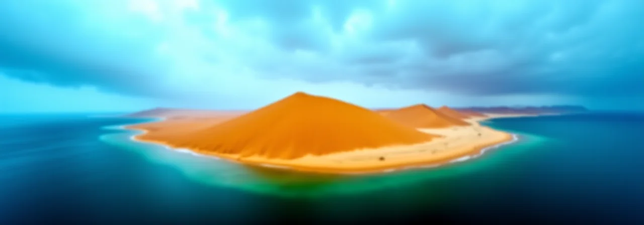
The sand dunes themselves, some reaching 180 metres tall, would become underwater ridges and shoals. The Erg Chebbi dunes in Morocco, currently a tourist attraction for their perfect orange crescents, would be submerged hills. Navigation charts for a Saharan sea would look strange: shallow water everywhere, with sudden underwater mountains where the great ergs once stood.
Beneath the sand sits bedrock, and beneath that, one of the largest aquifer systems on Earth. The Nubian Sandstone Aquifer holds an estimated 150,000 cubic kilometres of fossil water under Libya, Egypt, Sudan, and Chad. Flooding the surface above it wouldn't directly affect the aquifer (it's sealed by rock layers), but the weight of an ocean above it would increase subsurface pressure in ways that are difficult to predict.
Climate disruption
The Sahara influences global weather far out of proportion to its population. Its surface temperature regularly exceeds 50°C, creating a massive thermal engine that drives atmospheric circulation patterns across the Atlantic. The Saharan Air Layer, a hot, dry, dusty air mass that blows westward from Africa, suppresses Atlantic hurricane formation during early summer. Without it, hurricane season starts earlier and hits harder.
Replace the desert with a body of water and that thermal engine shuts down. Water heats and cools more slowly than sand. Daytime temperatures over a Saharan sea would peak around 30-35°C instead of 50°C. The temperature gradient between the Sahara and the equatorial forests to its south, which drives the West African monsoon, would weaken. Rainfall patterns across the entire Sahel would shift.
About 430 million people live in the Sahel, the semi-arid strip south of the Sahara. Their agriculture depends on seasonal monsoon rains arriving within a predictable window. A weakened monsoon means less rain, arriving later, distributed differently. Crop failures would cascade across some of the poorest countries on Earth.
Meanwhile, evaporation from a Saharan sea would inject enormous volumes of moisture into the atmosphere. Some of it would fall locally, potentially turning the Sahara's margins green. Some would drift east and north, altering rainfall in the Mediterranean basin and Southern Europe. Models disagree on the specifics, but every model agrees the changes would be large.
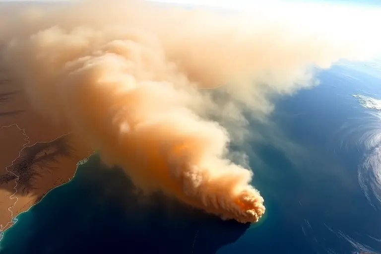
The Saharan dust pipeline
This is the consequence nobody thinks of first, and it might be the most important.
Every year, about 182 million tonnes of dust blow off the Sahara. Roughly 28 million tonnes of this reaches the Amazon basin, 6,000 kilometres away across the Atlantic Ocean. This dust contains phosphorus, an essential nutrient that Amazonian soils desperately lack because constant rainfall leaches it away. The Sahara, quite literally, fertilises the Amazon rainforest from across an ocean.
Flood the Sahara and the dust stops. The Amazon loses its primary external phosphorus source. Productivity declines. The rainforest, already under pressure from deforestation, loses a nutrient subsidy it has depended on for millions of years. How quickly this would matter is debated, but the phosphorus cycle in Amazonian soils operates on timescales of decades, not centuries.
Saharan dust also fertilises Atlantic phytoplankton, which produce about 20% of the world's oxygen through photosynthesis. Less dust means less iron for phytoplankton. Less phytoplankton means less oxygen production and less carbon dioxide absorption. The knock-on effects ripple through every ocean food chain on the planet.
The human cost
The Sahara isn't empty. About 2.5 million people live in it, mostly in oasis communities, along ancient trade routes, and in mining settlements. Millions more live on its margins. Algeria, Libya, Egypt, Niger, Mali, Chad, and Mauritania all have significant populations in or near the desert.
A sudden flooding would be a catastrophe of biblical proportions. A gradual one (over years or decades) would produce the largest forced migration in human history. Entire cities would need relocating. Tamanrasset, a city of 93,000 people in southern Algeria, sits at about 1,400 metres elevation and would survive. In-Salah, at 270 metres, would not.
The geopolitics are staggering. Seven countries share the Sahara. A new sea would redraw borders, create new coastlines, open shipping routes, and generate territorial disputes that make the South China Sea look straightforward. Who owns the mineral rights beneath a Saharan seabed? Who controls the straits between new islands that used to be mountain ranges?
The Sahara's sand conceals mineral wealth: iron ore, phosphates, uranium, oil and gas reserves beneath Libya and Algeria. Flooding would make extraction dramatically harder and more expensive, cutting off revenue streams that multiple governments depend on.
What you'd gain is a vast, warm, shallow sea teeming with potential for fisheries, solar-powered desalination, and coastal agriculture. In a few centuries, with coral colonisation and sediment redistribution, it might become productive. But the first century would be chaos, and the people bearing the cost of that chaos would overwhelmingly be Africans who didn't ask for it.